Vast stretches of Earth's northern latitudes are on fire right now. Hot weather has engulfed a huge portion of the Arctic, from Alaska to Greenland to Siberia. That's helped create conditions ripe for wildfires, including some truly massive ones burning in remote parts of the region that are being seen by satellites.
Pierre Markuse, a satellite imagery processing guru, has documented some of the blazes attacking the forests and peatlands of the Arctic. The imagery reveals the delicate landscapes with braided rivers, towering mountains, and vast swaths of forest, all under a thick blanket of smoke.
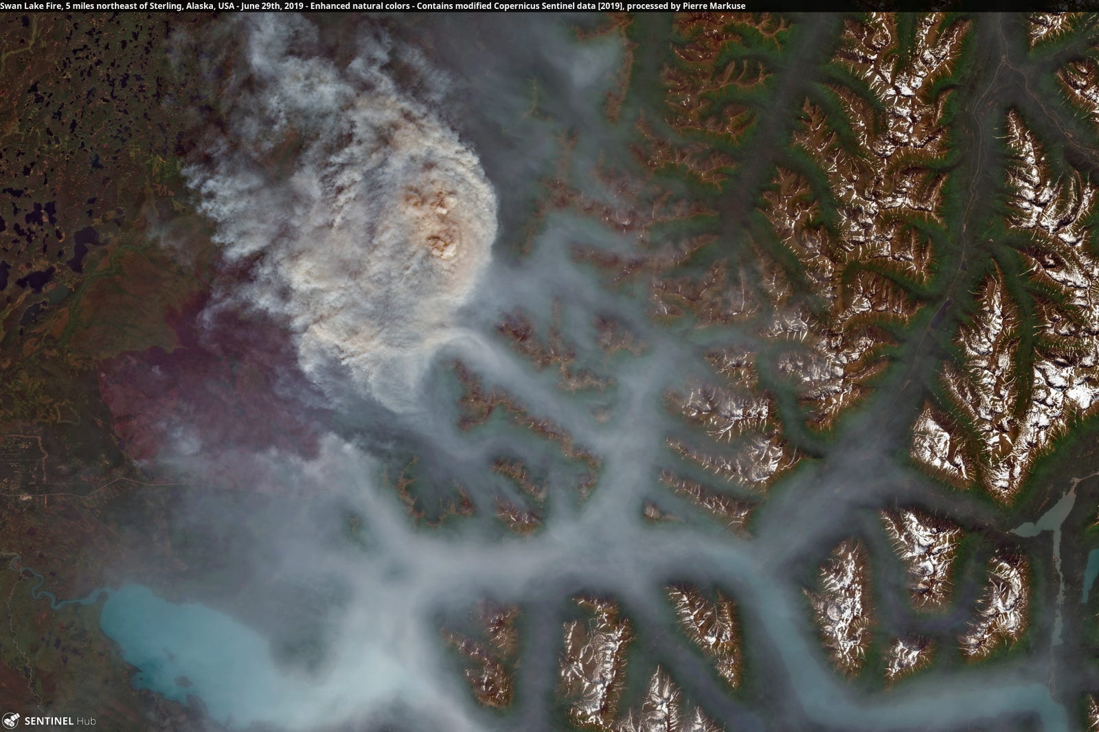
In Alaska, those images show some of the damage wrought by wildfires that have burned more than 1.6 million acres of land this year. Huge fires have sent smoke streaming cities earlier this month, riding on the back of Anchorage's first 90 degree day ever recorded. The image below show some of the more remote fires in Alaska as well as the Swan Lake Fire, which was responsible for the smoke swallowing Anchorage in late June and earlier this month.
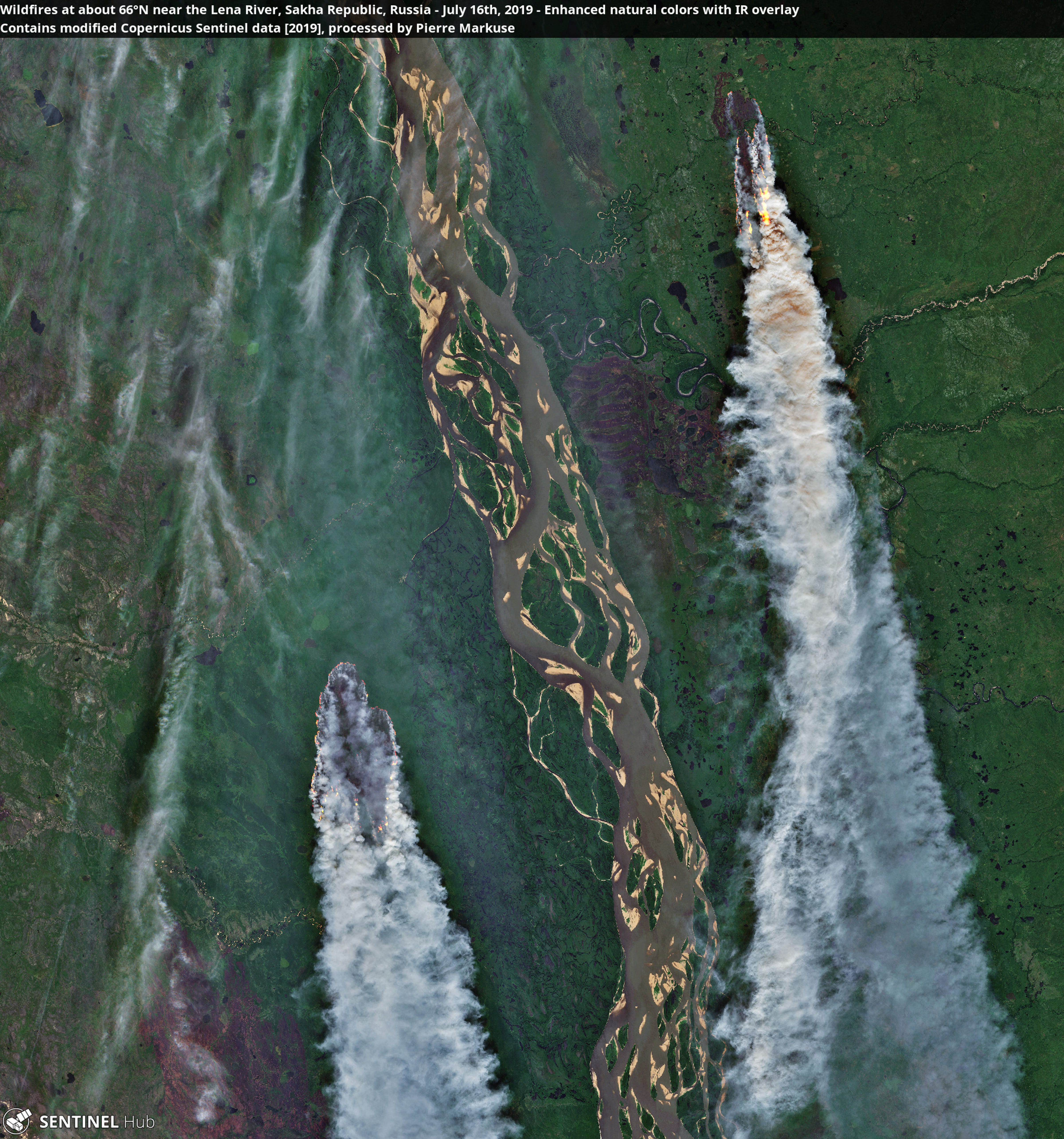
Intense hot conditions have also fanned flames in Siberia. The remote nature of many of the fires there means they're burning out of control, often, through swaths of peatland that's normally frozen or soggy. But as Thomas Smith, a fire expert at London School of Economics, noted on Twitter, there are ample signs the peat dried out due to the heat and is ablaze. That's worrisome since peat is rich in carbon, and fires can release it into the atmosphere as carbon dioxide. Peat fires can also burn underground into the winter and reignite in spring.
Not scary at all, nope.